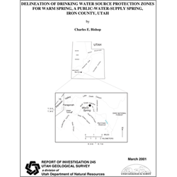
Delineation of drinking water source protection zones for Warm Spring, a public-water-supply spring, Iron County, Utah (RI-245)
By: C. E. Bishop
This study delineates drinking-water-source-protection zones for Warm Spring, which is used by the Paragonah Municipal Water System as a source of drinking water for the town of Paragonah. The spring is in Red Creek Canyon on the western edge of the Markagunt Plateau, in eastern Iron County. Red Creek is a substantial perennial stream draining the plateau. The climate of the area is semiarid to humid and average annual precipitation is about 14 inches; however, up to 35 inches can be received in the higher mountains.
This report describes the delineation of drinking-water-source-protection (DWSP) zones for Warm Spring, a public-water-supply spring in eastern Iron County, Utah. Warm Spring is about 4.1 miles east of the town of Paragonah, within the Markagunt Plateau. Much of the land surrounding the spring area is privately owned, but U.S. Bureau of Land Management, Dixie National Forest, and some state land is also found in the area. Grazing, recreation, and some residential development are the main land uses in the area. The town of Paragonah is a rural farming community that obtains part of its municipal drinking water from this spring. The Paragonah Canal Company owns the spring, and sells part of the water to the Paragonah Municipal Water System, which requested this delineation of DWSP zones. The scope of work included a literature search, review of water records, field reconnaissance, interpretation of data, delineation of the DWSP zones, and preparation of this report.
Other Information:
Published: 2001
Pages: 39 p.
Location: Iron County
Media Type: Paper Publication


