


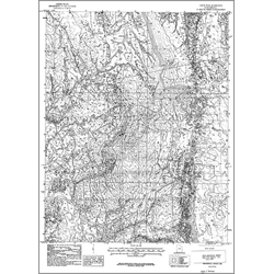
Geologic map of the Jarvis Peak quadrangle, Washington County, Utah (OFR-212)
By: B. J. Hammond
The Jarvis Peak Quadrangle in southwesternmost Utah encompasses the southern portion of the Beaver Dam Mountains and lies within the transition zone between the Colorado Plateau and Basin and Range physiographic provinces. The Beaver Dam Mountain uplift is a northwest-trending, doubly-plunging anticline bounded on the east by the Shivwits syncline. Information in this publication includes: a description of geologic units, a correlation of geologic units, a lithologic column, and a cross-section. This Open-File release makes information available to the public during the review and production period necessary for a formal UGS publication. This map may be incomplete, and inconsistencies, errors, and omissions have not been resolved. While the document is in the review process, it may not conform to UGS standards; therefore it may be premature for an individual or group to take actions based on its contents.
Other Information:
Published: 1991
Pages: 63 p.
Plates: 2 pl.
Scale: 1:24,000
Location: Washington County
Media Type: Paper Map