


The Prairie Canyon Member, a new unit of the Upper Cretaceous Mancos Shale, west-central Colorado and east-central Utah (MP 97-4)
By: R. D. Cole, R. G. Young and G. C. Willis
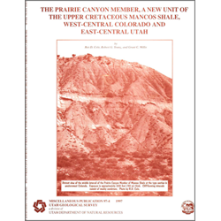
For more than 30 years, surface and subsurface investigations of Upper Cretaceous strata in the southeastern Uinta Basin, southwestern Piceance Creek Basin, and along the intervening Douglas Creek arch, have documented that the upper Mancos Shale is anomalously sandy and contains commercial quantities of natural gas. Previous workers informally named this interval the sandy Mancos zone, B zone of the Mancos Shale, or the Mancos B , and assigned thicknesses ranging from 385 feet (117 m) to more than 1,220 feet (372 m). This sandy zone forms a badlands-type terrain near the base of the Book Cliffs from Grand Junction, Colorado, to Woodside, Utah. Because this unit has economic significance and can be mapped at the surface and in the subsurface, it is herein formally named the Prairie Canyon Member of the Mancos Shale. A new type section is defined in the Prairie Canyon area of westernmost Mesa County, Colorado. Subsurface well logs and cores are also utilized to supplement stratigraphic and sedimentologic characterization of the Prairie Canyon Member.
Other Information:
Published: 1997
Pages: 23 p.
Location: Grand County
Media Type: Paper Publication