


Geologic map of the Hayes Canyon quadrangle, Sanpete County, Utah (MP 97-3)
By: D. H. Petersen
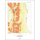
The Hayes Canyon quadrangle is in the transition zone between the Colorado Plateau and the Basin and Range Physiographic Provinces and includes the eastern part of the Valley Mountains and the western part of Sevier Valley. Exposed bedrock includes the upper 450 feet of the Paleocene North Horn Formation; the Paleocene to Eocene Flagstaff Formation, which is divided into a lower member about 450 feet thick, a middle member 175 to 300 feet thick, and an upper member 250 to 300 feet thick; the Eocene Colton Formation, which is 300 to 450 feet thick; and the Eocene Green River Formation, which is at least 400 feet thick. The Miocene to Pliocene Sevier River Formation unconformably overlies the Green River Formation in the area and, although not exposed in the quadrangle, probably is present beneath surficial deposits. Alluvial, fluvial, colluvial, and mass-movement deposits are locally present. Lacustrine and floodplain sediments are found in the Sevier Valley.
Other Information:
Published: 1997
Pages: 18 p.
Plates: 2 pl.
Scale: 1:24,000
Location: Sanpete County
Media Type: Paper Map