


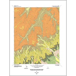
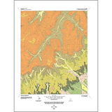
Geologic map of the Podunk Creek quadrangle, Kane County, Utah (MP 01-3)
MP 013
In stock
1:24,000 Geologic Maps
$8.95
By: T. L. Tilton
The Podunk Creek quadrangle is located in north-central Kane County, covers the southeastern part of the Paunsaugunt Plateau, and includes a part of Bryce Canyon National Park. The approximately 2,700-foot-thick section of exposed sedimentary rocks in the quadrangle ranges in age from Late Cretaceous to Eocene. Quaternary alluvium, mass-movement debris, pediment alluvium, and landslides cover these rocks. Volcanic flow and dike basalts of Quaternary age are present in the south-central part of the quadrangle.
Other Information:
Published: 2001
Pages: 18 p.
Plates: 2 pl.
Scale: 1:24,000
Location: Kane County
Media Type: Paper Map