


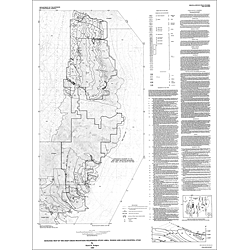

Geologic map of the Deep Creek Mountains wilderness study area, Tooele and Juab Counties, Utah (MF-2099)
MF2099
In stock
1:62,500 and 1:50,000 Geologic Maps
$5.00
By: D. W. Rodgers
Geologic maps use a combination of colors, lines, and symbols to depict the relative age, composition, and relationships among rocks and sediments at and near the earth's surface.
Other Information:
Published: 1989
Plates: 1 pl.
Scale: 1:50,000
Color/B&W: B&W
Location: Juab County and Tooele County