


Geologic Map Of The Bailey's Lake Quadrangle, Salt Lake and Davis Counties, Utah (M-281dm)
By: Adam P. McKean, and Michael D. Hylland
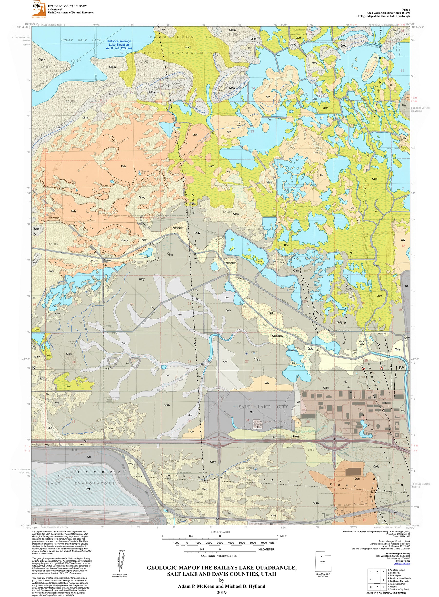
The Baileys Lake quadrangle is in the northwestern part of Salt Lake County and western part of Davis County, Utah. The map area contains the northern part of the Kennecott Utah Copper, LLC tailings impoundment, Interstate 80, agricultural and pasture land, the southern part of the Farmington Bay Waterfowl Management Area, the International Center commercial area, site of the under-construction Utah State Prison, landfills, migratory bird refuges, and a number of duck hunting club wetlands. No bedrock is exposed in the quadrangle. The map area is all valley floor that is covered by Quaternary lacustrine, deltaic, alluvial, and marsh deposits. The quadrangle contains the northwestern part of the Granger fault of the Holocene-active West Valley fault zone. The Granger fault is antithetic to the Salt Lake City segment of the Wasatch fault zone to the east. Lacustrine deposits are from late Pleistocene Lake Bonneville (30 to 13 ka), the Gilbert-episode lake (~11.5 ka), and Holocene Great Salt Lake (since ~11 ka). Alluvial and deltaic features include active stream deposits, paleo-Jordan River deposits, incised channels, and paleodeltas.
Other Information:
Published: 2019
Pages: 28
Plates: 2
Scale: 1:24,000
Location: Utah
Media Type: Paper Publication