


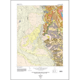
Geologic map of the Ogden 7.5-minute quadrangle, Weber and Davis Counties, Utah (M-200)
By: W. A. Yonkee and M. Lowe
The Ogden 7.5-minute quadrangle includes parts of Utah?s Wasatch Range and Wasatch Front basin, which preserve a rich geologic history. Bedrock exposed in the Wasatch Range consists of Early Proterozoic high-grade metamorphic and igneous (basement) rocks of the Farmington Canyon Complex, Paleozoic sedimentary rocks, rocks altered and deformed during the Cretaceous, and small Tertiary igneous dikes. The Farmington Canyon Complex includes abundant migmatitic gneiss, quartz-rich gneiss, and biotiterich schist derived mostly from metamorphism of sediments, and granitic gneiss derived from large plutons, which all underwent high-grade metamorphism associated with major mountain building. Paleozoic strata include a basal quartzite and overlying carbonate-rich sequence, which record shifting patterns of mostly shallow-marine deposition following rifting of the western margin of North America. During the Cretaceous Sevier orogeny, these rocks were thrust faulted, folded, and underwent local low-grade metamorphism and alteration. During late Cenozoic basin-and-range extension, basin fill consisting of clastic sediments and minor tuff accumulated in the Wasatch Front basin as the Wasatch Range was uplifted and eroded.
Other Information:
Published: 2004
Pages: 42 p.
Plates: 2 pl.
Scale: 1:24,000
Location: Davis County and Weber County
Media Type: Paper Map