


The geology of Kane County, Utah: geology, mineral resources, and geologic hazards (M-121)
By: H. H. Doelling and F. D. Davis
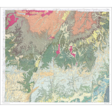
Kane County, with its 4105 square miles, lies along the south-central margin of Utah and is found in the western part of the Colorado Plateaus physiographic province. It is famous for scenic beauty displayed in its colorful rock formations and other geologic features such as faults, folds, arches, monoclines, joints, cross beds, cliffs, lava fields, and canyons. Kane County contains parts of Bryce and Zion National Parks, the Glen Canyon Recreation Area, and it is home to the Coral Pink Sand Dunes and Kodachrome Basin State Parks. The county area has had an interesting geologic history and important fossil finds have added much to our knowledge of world geology.
Other Information:
Published: 1989
Plates: 10 pl.
Scale:1:100,000
Location: Kane County
Media Type: Paper Publication