


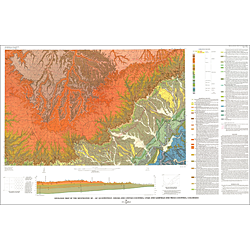
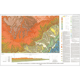
Geologic map of the Westwater 30' x 60' quadrangle, Grand and Uintah Counties, Utah and Garfield and Mesa Counties, Colorado (I-1765)
I1765
Unstocked
1:100,000 Geologic Maps
$12.95
By: J. L. Gualtieri
Geologic maps use a combination of colors, lines, and symbols to depict the relative age, composition, and relationships among rocks and sediments at and near the earth's surface.
Other Information:
Published: 1988
Plates: 1 pl.
Scale: 1:100,000
Color/B&W:
Location: Grand County and Uintah County