


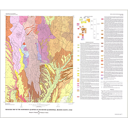

Geologic map of the northwest-quarter of the Beaver [Gillies Hill] quadrangle, Beaver County, Utah (I-1445)
I1445
In stock
1:24,000 Geologic Maps
$7.95
By: M. N. Machette and T. A. Steven
Geologic maps use a combination of colors, lines, and symbols to depict the relative age, composition, and relationships among rocks and sediments at and near the earth's surface.
Other Information:
Published: 1983
Plates: 1 pl.
Scale: 1:24,000
Color/B&W: Color
Location: Beaver County