


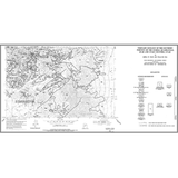


Geologic Map of the West Half of the Loa 30' x 60' Quadrangle, Garfield, Piute, and Wayne Counties, Utah (M-292DM)
M-292DM
In stock
1:62,500 and 1:50,000 Geologic Maps
$14.95
by Robert F. Biek, Jeffrey G. Eaton, Peter D. Rowley, David B. Hacker, Stephen R. Mattox, Christopher Bailey, and David W. Marchetti
Summary:
The west half of the Loa 30'x60' quadrangle covers the Awapa Plateau and adjacent areas along the southeast flank of the Marysvale volcanic field west of Capital Reef National Park. The gently east-tilted plateau is bounded on the west by the Paunsaugunt fault zone and on the east by the Thousand Lake fault zone, both active normal faults that have significant Quaternary displacement. Parts of Boulder Mountain, which supported an ice cap during the last glacial maximum, and the Monroe Peak caldera, source of the Osiris Tuff, the most distinctive and widespread ash-flow tuff in the volcanic field, are in the map area. This geologic map and explanation highlight the volcanic history of this region, which includes elements of basin-range, Colorado Plateau, and Marysvale volcanic field structure and stratigraphy.
Other Information:
Published: 2023
Pages: 42
Plates: 2
Scale: 1:62,500
Location: Utah
Media Type: Paper Map with report