


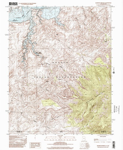
Cleopatras Chair, Utah - 7.5 Minute Series Topo Map
The distinctive characteristic of a topographic map is that the shape of the Earth's surface is shown by contour lines. Contours are imaginary lines that join points of equal elevation on the surface of the land above or below a reference surface, such as mean sea level. Contours make it possible to measure the height of mountains, depths of the ocean bottom, and steepness of slopes. A topographic map shows more than contours. The map also includes symbols that represent such features as streets, buildings, streams, and vegetation.
This 1:24,000 scale topographic map, also known as a 7.5 minute topographic, covers approximately 7 by 9 miles. The contours and elevations on this scale map are shown in feet.
Other Information:
Published: 1988
Scale: 1:24,000
Media Type: Paper Map
Location: San Juan County and Wayne County